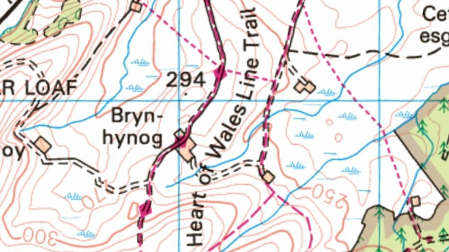
Walkers will find it easier to navigate their way along the long-distance Heart of Wales Line Trail since its recent addition to the Ordinance Survey digital maps.
The 141-mile-long walking route, which completed its launch in the Spring of 2019, is based on existing rights of way, starting in the old railway town of Craven Arms.
The trail passes through remote upland areas including Shropshire, the Radnorshire Forest and Brecon Beacons, glorious woodland and the salt marshes of the Loughor Valley en route to the Millennium Coastal Park in Llanelli.
While appealing to walkers who seek a long-distance challenge, the trail is equally suitable for those who wish to walk it in sections, using the train to access day or weekend walks and using local shops, cafes, pubs and overnight accommodation along the way.
OS managing director for leisure, Nick Giles said: “It is fantastic the full 141 miles of this trail is available on our digital OS Maps to aid walkers and adventurers as they explore the glorious Welsh countryside, from the Marches to the South Wales coast and everywhere in between.
“We want to help more people to get outside more often, so whether you’re just after a short walk in the morning, or a full adventure along the Heart of Wales Line Trail, OS Maps on your phone or online will help you navigate it safely.”
The trail is looked after by a small band of volunteers and Trail Champions who check the condition of the route, make regular repairs as well as many more improvements such as better signposts to help keep the trail relevant and useable in the future.
Mike Watson, co-ordinator of the Heart of Wales Line Trail Steering Group said “We are delighted that the Trail is now marked on OS electronic maps. This will be of real assistance to walkers, as I have found already when out on the route, and will be a big help in our efforts to get the Trail better known”
More information about the trail and route instructions can be viewed and downloaded by visiting https://www.heart-of-wales.co.uk/experiences

